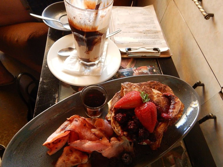
Day 1
Melbourne city – Dandenong via train. Dandenong – Rawson via bike
Plan A was to ride only 40km from Moe to Rawson, but the regional trains were not running.
Plan B was to ride 115km from Pakenham to Rawson, as the metro trains were running from Melbourne to Pakenham.
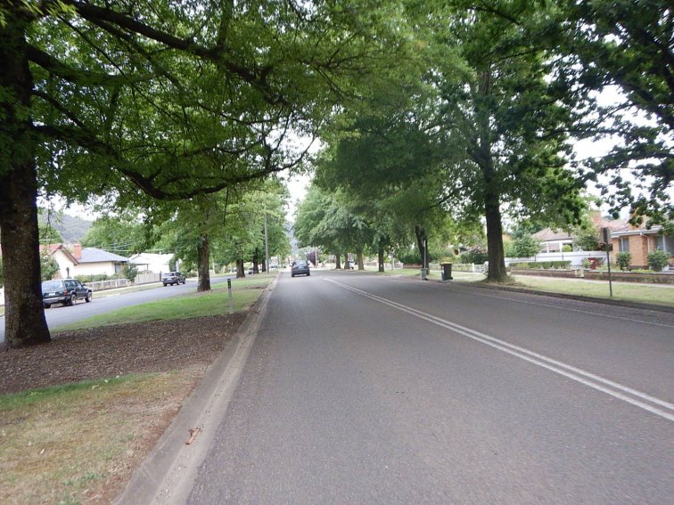
Then I had to implement Plan C, as I discovered when I arrived in Melbourne that the trains were only running as far as Dandenong, so it was a 140km ride all up.
Pre riding activities: up at 7:15am, pack luggage onto bike, breakfast in Melbourne, ride to Flinders St station, wait 15 min for train, take train 45min to Dandenong.
Start riding time: 11am
Finish riding time: 7:15pm
Total time start to finish: 8:15
Total riding time: 7:25
Total stops time (excluding short stops eg <5 min): 50min (lunch and toilet stop in Longwarry, afternoon tea stop)
Distance: 140km
Elevation gain: 1527m
Elevation loss: 1086m
Average moving speed: 19kph
Food: bircher muesli, small long mac, 4 x muesli bars, almond croissant, miso soup, savoury mince and rice
Drinks: 2L water, 600mL SIS electrolyte tab, 500mL reconstituted fruit juice powder
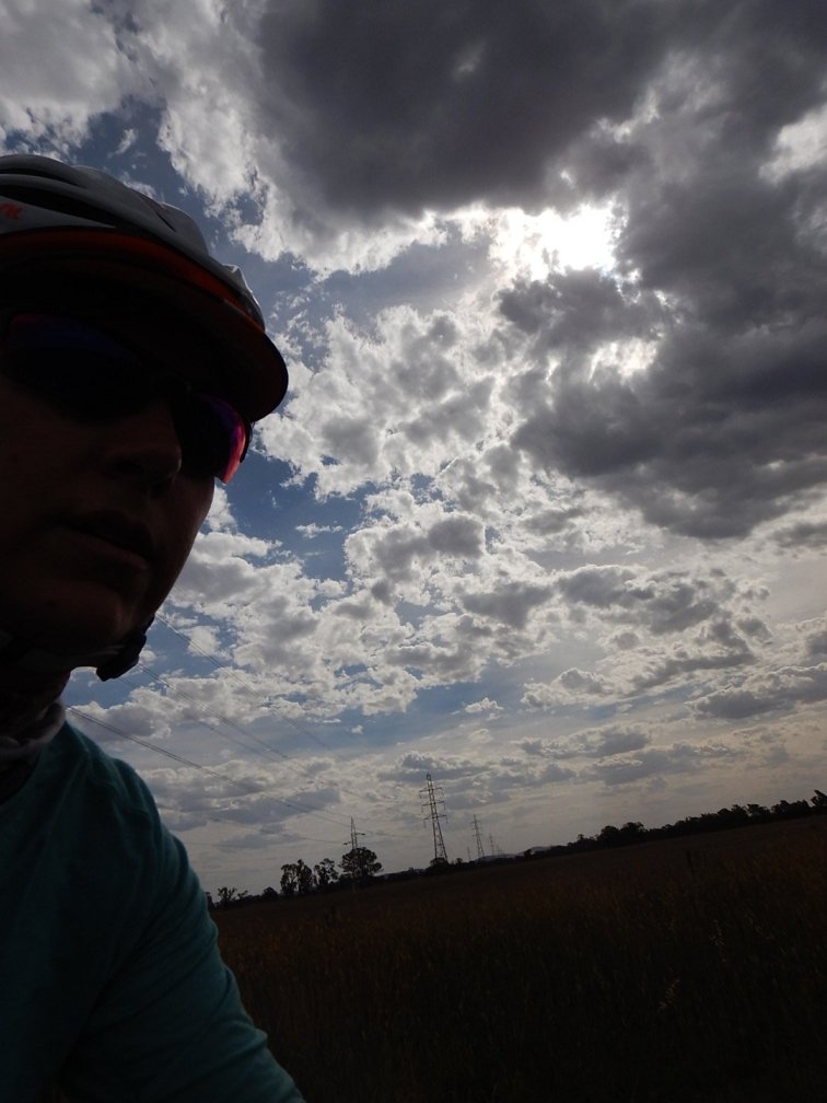
Weather: Ideal! High 20s/ low 30s with a light breeze. I got a bit warm in the middle of the day, but the breeze was lovely and actually became a tailwind for a great 20km stretch.
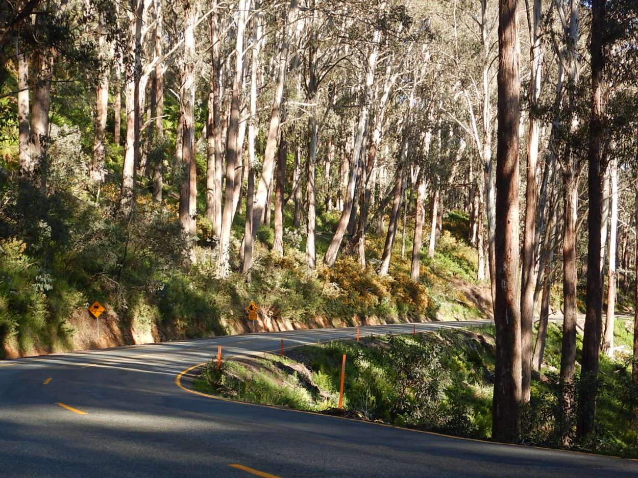
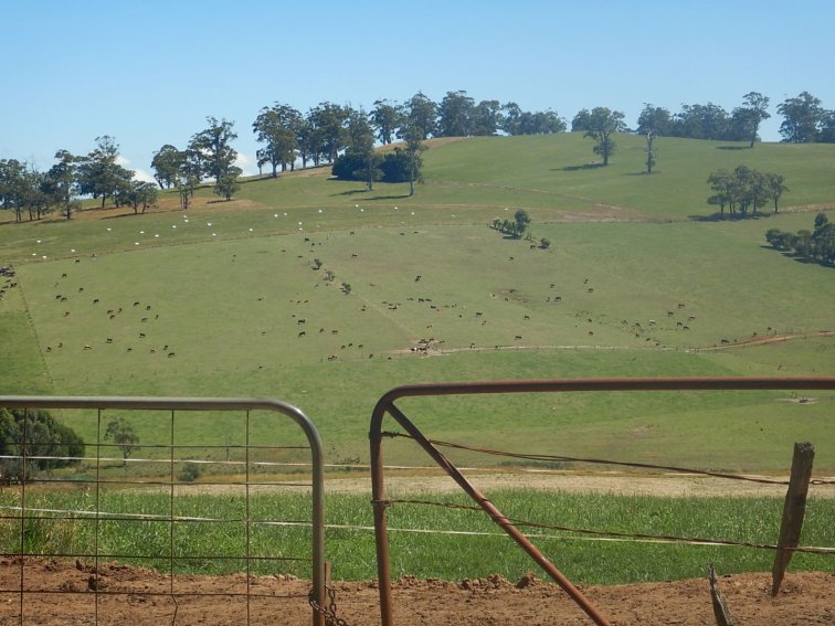
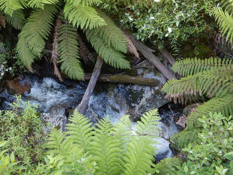
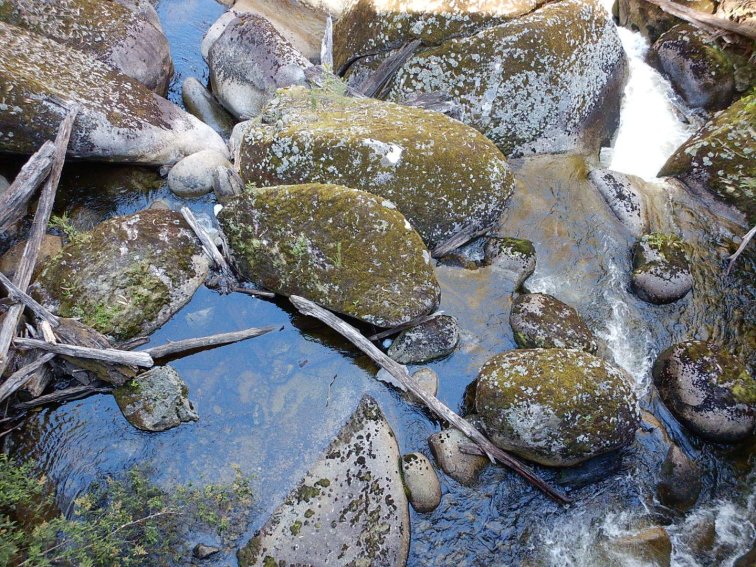
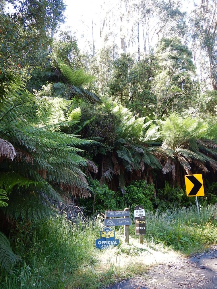
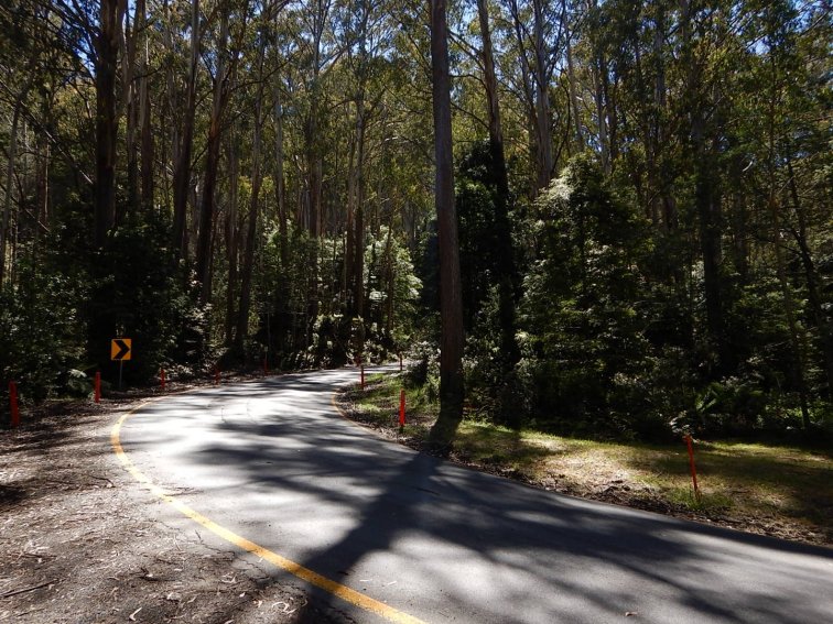
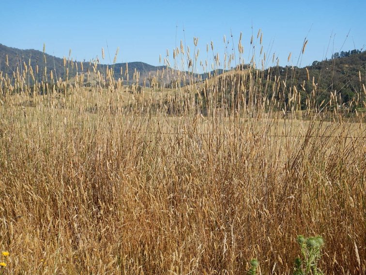
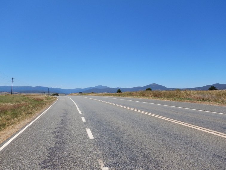
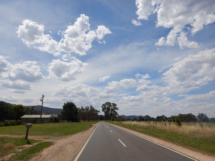
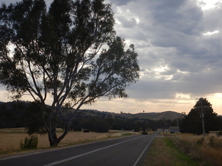
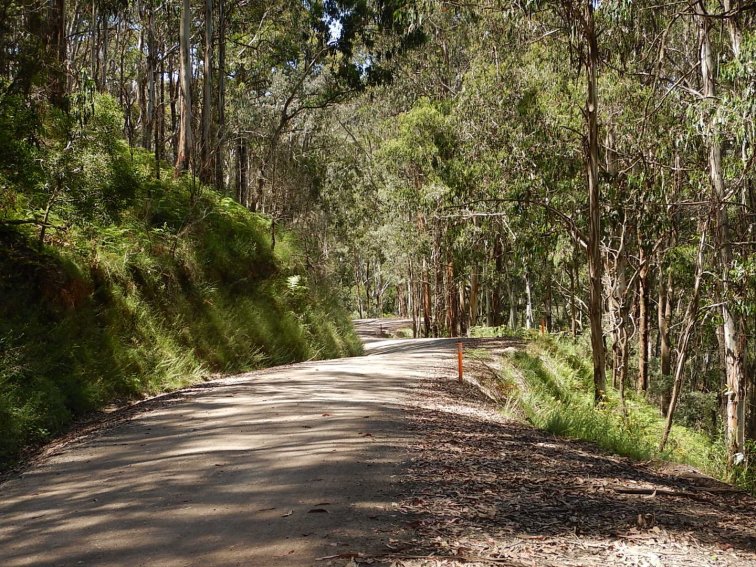
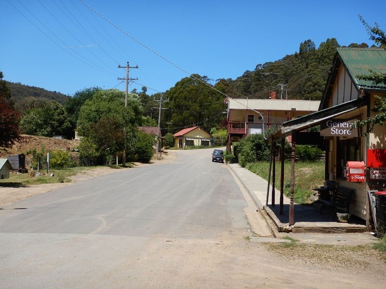
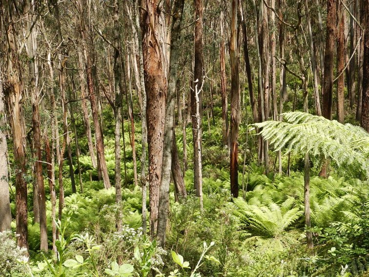
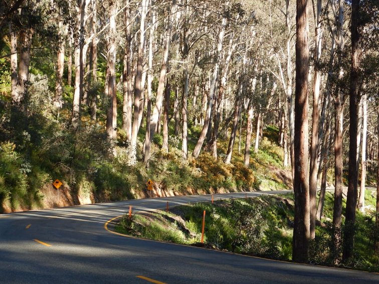
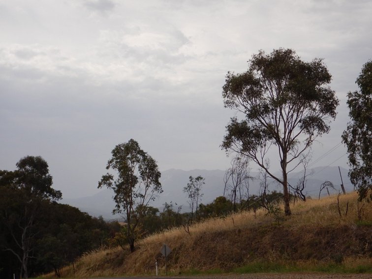
Terrain overview: First 30km Dandenong to Pakenham on a moderately busy 3 lane 80kph highway with only intermittent bike lanes and lots of shops, service stations etc along the whole stretch. Not ideal but most drivers were pretty good. Next 30km Pakenham to Longwarry essentially flat and straight, alongside a railway. Very rural but the towns along here were not as tiny as I expected and the short main street of Garfield in particular looked inviting. Next 50km on Old Sale Rd – even more rural and agricultural, dairy country, great vistas of rolling green patchwork hillsides with cows and mountains in the distance. This made for very undulating terrain, all up and down, but reasonably short hills. One was a bit steep and tested my gearing. The towns along here were tiny hamlets but the houses and gardens were really well kept. Last 30km mostly uphill, mostly quite long climbs, got into forest then ferns and apparently koala country although I didn’t see any. Hard to watch for koalas when you’re trying to ride in a straight line up a hill. Tough but so great to reach Erica, which was lovely – and then see a big climb out of Erica and think, well at least I’m not going to be faced with that first thing in the morning, as I had to ride 5km past Erica to Rawson for my accommodation. All sealed roads.
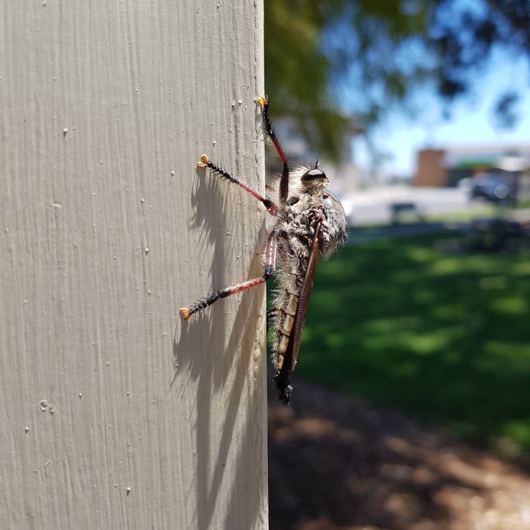
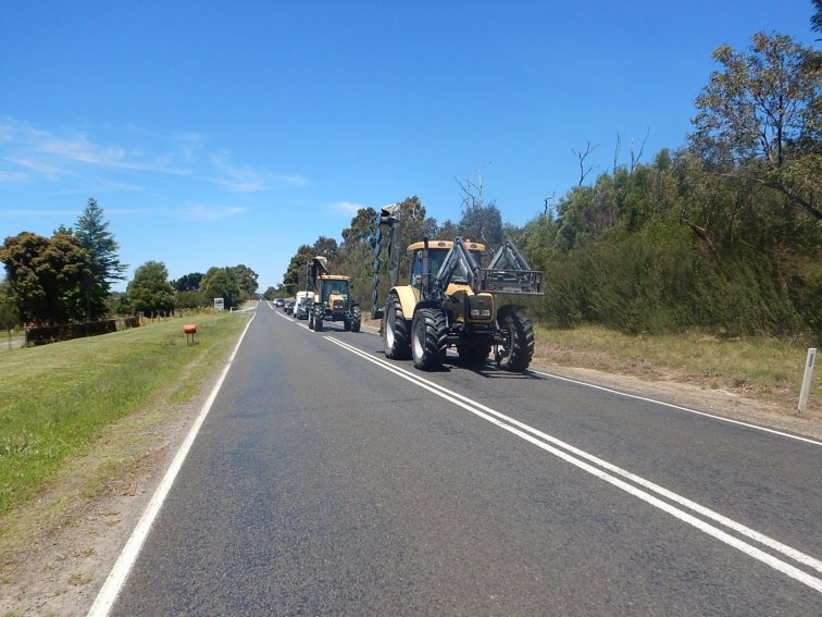
Interesting sights: 1 live snake on the road, rusty barbed wire on the road, 1 dead echidna, 1 live echidna crossing the road, 2 wedge tail eagles lifting off from a paddock with a rabbit they’d caught, 7 tractors and 3 sports cars driving on the road
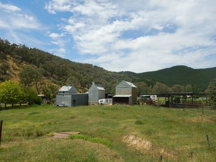
Highlights: Old Sale Rd – quiet, decent road surface, scenic and interesting terrain. Arriving at my accommodation in Rawson – the scenery was so beautiful! And the owner said I could leave my luggage in my room during the day while I did the Mt Baw Baw climb the next day.
What I’ve learnt: Even the best laid plans need to be adjusted. When your plans change, rethink everything to see if it will change anything else (e.g. needing more food and water for a longer ride). A realistic/ worst case plan allows room for adjustment on the road, and prepares you mentally for a hard day, then if things go well you feel great because you finish early. Put sunscreen on thighs and calves at the start of the day and each stop thereafter. Wearing a backpack makes me sweat more. It is ok to feel like crap at various times. It can be helpful if you know why you feel like crap so you can do something about it. I don’t cope so well with heat. Today would have been ideal if I’d been able to do Plan B, as the flat terrain at the start was a perfect warm-up, but I would have avoided the 30km of highway at the start. I didn’t get my usual post- flight crap feeling. I wouldn’t have seen some of my highlights if I’d been able to do Plan A.
Day 2
Rawson – South Face Rd (unsealed) – Mt Baw Baw climb (sealed) then back. Then sealed road to Thomson Dam and last 10km unsealed to a bush campsite.
Pre-riding activities: Up at 6am, breakfast and re packing bags as much as I could.
Start riding time: 7:45am
Finish riding time: 6:45pm
Total time start to finish: 11 hours
Total riding time: 9:40. Mt Baw Baw climb 1:13 without luggage.
Total stops time: 1:20 – roadside toilet break at the bottom of Mt Baw Baw, lunch at the cafe at the top, afternoon tea and packing bike back at my accommodation.
Distance: 101km + approx 5km lost due to Garmin GPS issues – nothing a restart couldn’t fix.
Elevation gain: ~3000m
Elevation loss: ~2800m
Average moving speed: 11kph overall. Mt Baw Baw 5kph, undulating on gravel 10kph.
Food: porridge + 1 Tbsp MCT oil + 1 pat honey, 4 Muesli bars, 3 vitawheat crackers with peanut butter, an iced coffee and a ham and cheese toastie at the Mt Baw Baw cafe, carried from Melbourne 2 x sourdough toast with jam and butter, soaked in 150mL milk, large bowl of fruit salad, homemade dehydrated Louisiana spicy mince with quinoa and a fire-baked potato cooked to perfection from my campsite neighbours with butter.
Drinks: coffee and 2 tbsp Milo in 600mL bottle, miso soup, a cup of extra water with my dinner (soupy), 3.2L water.
Weather: Beautiful one day, perfect the next. It got hot in the middle of the day when there was no tree shade on the road, felt like mid 30s. The rest of the day was sunny, warm with a gentle breeze. At the top of Mt Baw Baw I didn’t even need a jacket although I was grateful for my rain jacket for the quick descent back down, as my sweat had cooled off and it would have been chilly otherwise. The jacket came off as soon as I got to the bottom though.
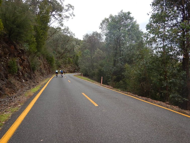
Terrain overview: 5km undulating to South Face Rd. South Face Rd was 27km of unrelenting undulations on unsealed road, long uphills broken by brief downhills. Mt Baw Baw was steep of course but not as bad as I’d thought. The base gradient was 10-12% and there were significant sections probably about 15%. I was very happy not to have my luggage with me. My cadence was 45rpm and power around 160-190W. Then back along South Face Rd – the downhills were nice but there seemed to be more uphill than there was downhill on the way out. Back to Rawson then load up with luggage. Then next 20km north from Rawson was on sealed roads, more unrelenting undulations and long climbs. Then I crossed Thomson Dam wall and straight away had a steep 1.5km climb, I’d guess as steep as Mt Baw Baw but this time with luggage. I got over that with one break along the way. The last 10km to camp was on gravel road. Where it wasn’t corrugated or full of potholes the road condition was awesome! Then the last 5km I turned onto a track – I knew it was steep downhill and I’d been worried it would be unrideable (rutted and gravely like it would be in Perth). I was pleasantly surprised it was in better condition than the dirt road I’d been following, compacted clay and rocks. But it was all downhill and steep – it will be a tough start to the day tomorrow.
Interesting sights: 2 wallabies with small heads, round bodies and big long tails like door draught stops, asphalt in the car park at Mt Baw Baw that looked solid but melted when you touched it and stuck to everything – bike shoes, bike wheels.
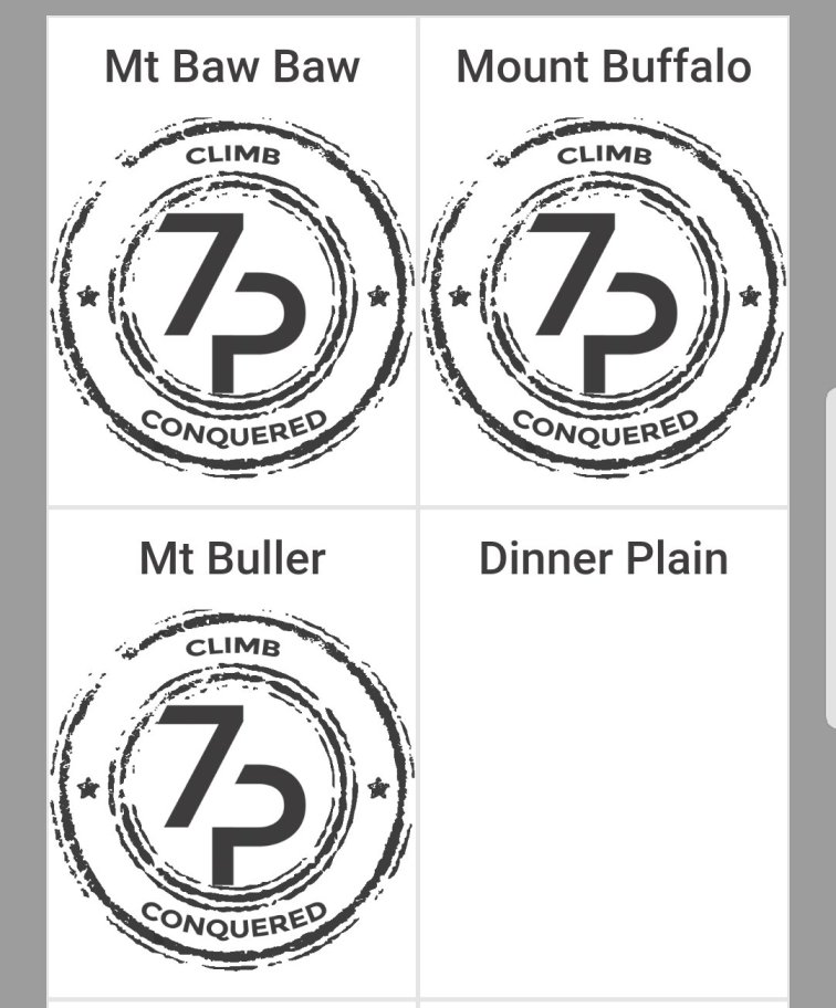
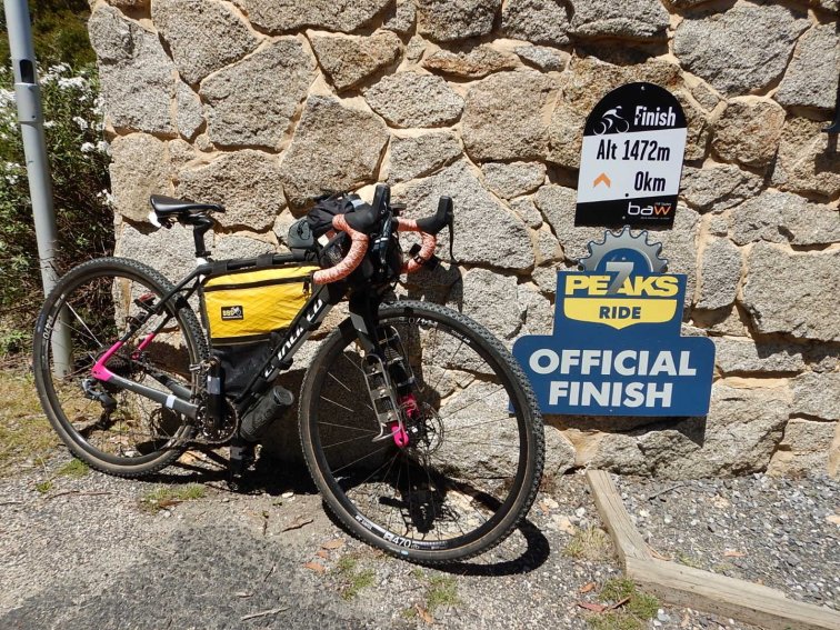
Highlights: Climbing Mt Baw Baw and conquering another of the 7 Peaks!
After seeing a bunch of 4WDs and a sign saying “18th” pointing in the direction of my planned hut/campsite, I decided to try the alternate and closer “Merington flat camp area”. It was huge and there was only one other family there, who shared with me amazing fruit salad and potato cooked in the fire, as well as gave me water to refill my bottles so I didn’t have to filter any water.
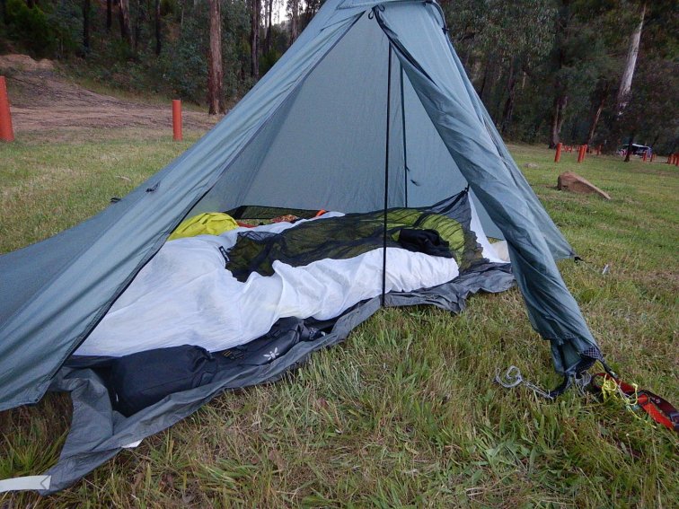
What I’ve learnt: I need a fork with inbuilt lugs, as I’ve broken one of my USB adaptors already. Homemade pot cosy works perfectly for rehydrating food! Boiling water + homemade dehydrated meal + pot cosy + 15 min = dinner. I need to finish earlier than 6:30pm if I want to eat in daylight i.e. before 9pm. To put up my tent for the best shape I need to peg the four corners then put the pole in. Don’t pack toiletries in a bag where you’ll be tempted to shove and squeeze them to fit in – particularly if they contain toothpaste.

- South Face Rd – gravel but pretty good condition
- Christmas Creek on Christmas Eve
Merrington flats campsite to camp alongside Goulburn River, between Kevington and Jamieson – all unsealed roads.
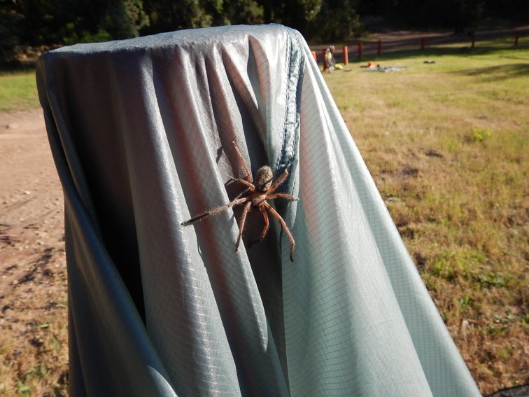
Pre-riding activities: Up at 5:30am, replaced broken USB fork mount adaptor and taped all of the other adaptors. Breakfast, got camping gear dry and packed. Also discovered the size of the giant spider I’d shared my tent with half the night! I woke up during the night and saw this black shape with lots of legs a few centimeters from my face, thank goodness I was inside my bivy zipped up and the spider was “only” on the inside of the outer tent. Even that was too close for comfort but I resolved there wasn’t much I could do in the middle of the night. Good thing I hadn’t appreciated how large it was! I thought the spider must have found somewhere more appealing to hang out, then as I was turning my tent inside out to dry this giant huntsman crawled out – it was about twice as big as I thought, and I’d been in my tent getting changed with it earlier in the morning!
Left camp just before 9am (an hour behind my planned depart time) and (unbeknownst to me) dropped one of my 1L bidons as I turned to head up the track from camp.
Start riding time: 8:50am
Finish riding time: 6:10pm
Total time start to finish: 9:20
Total riding time: 8:25
Total stops time: 1 hr – lunch in a gazebo just before Woods Point with a lovely couple who were out for a Christmas 4WD escape, heading to Mt Buller/ Craig’s Hut. Toilet at Woods Point.
Distance: 99km + approx 2km lost to Garmin fail.
Elevation gain: 1830m
Elevation loss: 1970m
Average moving speed: 11.7kph
Food: porridge with 2 x marmalade pats and 2 spoons of MCT oil. 3 muesli bars. 2 shop bought (in Perth) gluten free crumbly crumpets with 2 butter pats (1 on each), 1 vegemite pat and 3 slices of tasty cheese. 3 vitawheat crackers with a large pat of nutella, 4 vitawheat crackers with 2 slices of cheese, miso soup, savoury mince and rice, 1 piece of Christmas cake.
Drinks: coffee and Milo in 600mL bidon, 600mL bidon with SIS electrolyte tab, 3.5L water.
Weather: Another great day but on the hot side. Shade and the breeze were welcome. Today I could feel the effects of the heat on my mood and energy from 12-4pm.
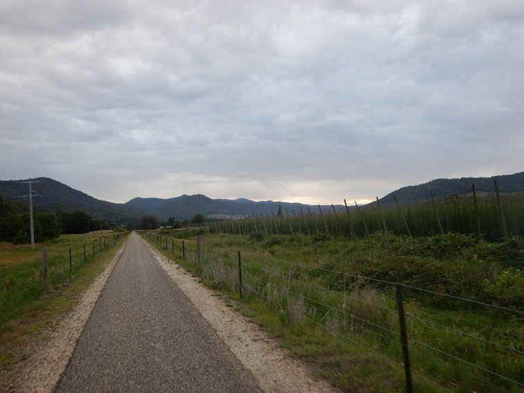
Terrain overview: Oh the corrugations! I was literally as slow going downhill as uphill, and sometimes slower, trying to find a decent line and sometimes just having to creep my way down the corrugations as big as speed bumps to try to minimise damage to my luggage, my bike and myself. The entire day was off-road, oh and the first 15km was a steep climb. The road continued up and down for 60km, then there was a big downhill and the rest flat. I still couldn’t gain any speed/ time thanks to the corrugations. The last 50km followed the Goulburn River which was lovely. And the first section had some glorious tree ferns and large trees. I very much doubt I will ever ride it again.
Interesting sights: 2 wallabies, 1 racehorse gonna, 1 black snake sunning itself by the side of the road, 1 tiny brilliant blue butterfly flying along with me, 1 giant dead tree across the road from the campsite fell over out of the blue.
Highlights: Riding all the way up the hill out of the camp area without stopping – 4km all up, and it only took me 40 min!
The kindness of strangers.
When my neighbours from my morning campsite finally caught up to me at 11:30am and returned the bidon I’d dropped, then refilled my remaining bottles with cold water. My lunch companions also offered me cold water to refill my bottles. Good thing as there was (unsurprisingly) nothing open in Woods Point.
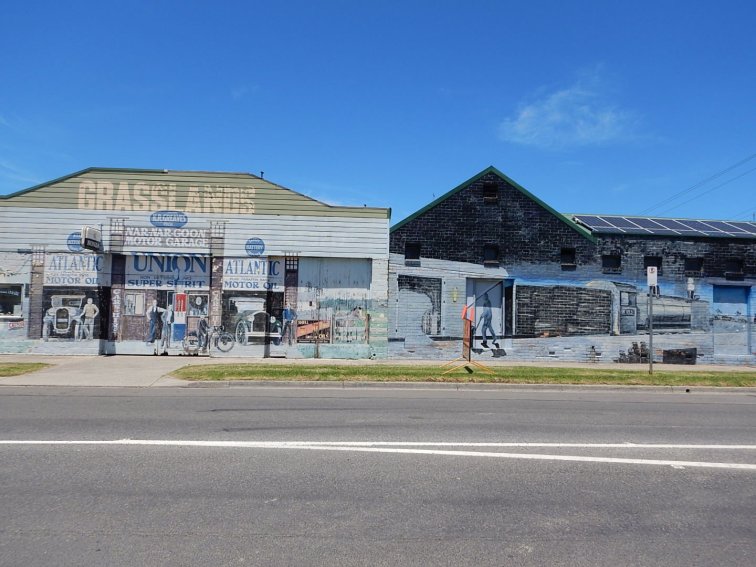
All the tiny towns I went through along the way, as each one had a small stretch of bitumen for the couple of kilometres that was the extent of the few houses making up the town – and I was so grateful each time!
Achieving my secret target for today by adding on an extra 20km, and staying at the last campsite instead of the first one – and best of all it was past the end of the dirt road!
The last piece of Carol Williams homemade special Xmas cake for dessert. Getting through today without losing my shit and with my bike and luggage intact.
What I’ve learnt: If you hear something odd or feel something odd, stop and check what it is and if you’ve dropped something. Everything is essential, and you won’t go back if you find later that something is missing. Reasons for sleeping in a bivy with an insect screen: you can see the stars but the spiders can’t get in. Uses for a buff #386: wrapping around a bidon as an extra strap when it is hanging off the front. I can’t average faster than 10kph on gravel roads, no matter my expectations otherwise or the terrain. If the gravel road is any kind of useful short cut or access road, which is the main reason I’d be taking it, the road will also be well used by vehicles and in that case it will be corrugated! I can arrange 20kph on sealed roads, so the off-road shortcut would have to be shorter than half the distance for me to gain any time, and the riding would still be awfully frustrating.
- My unwelcome visitor into my tent during the night!
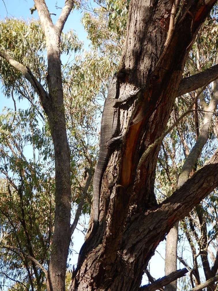
- Spot the goanna

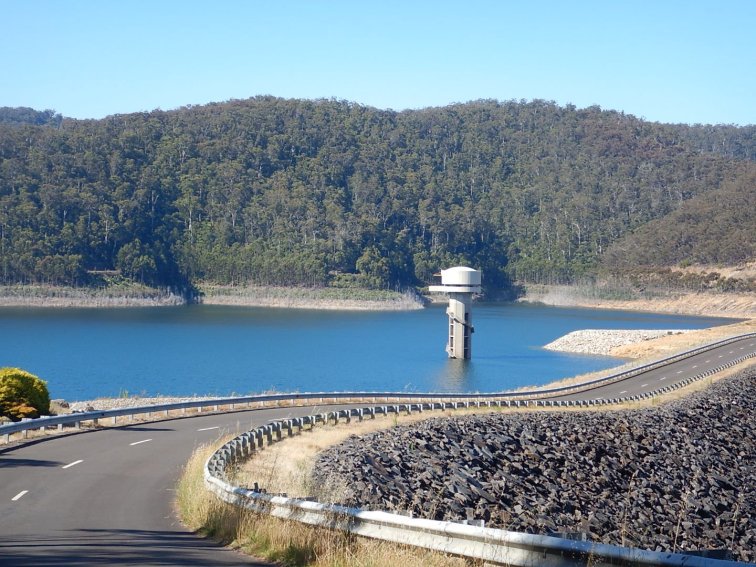
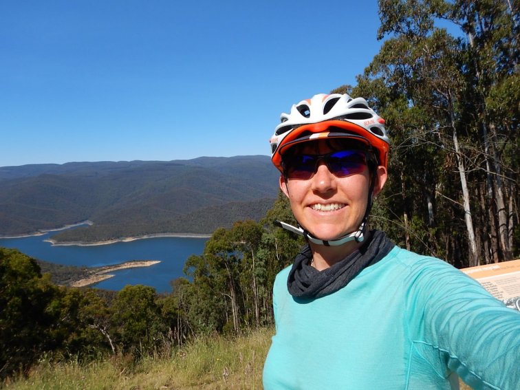
- Thomson Dam – it provides some of the water for Melbourne City.
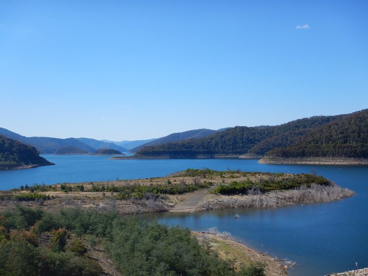
- Beautiful scenery but slow roads
- Woods Point, Christmas Day – unsurprisingly, everything was closed and not a soul in sight. So grateful I got water from friendly fellow travellers!

- The corrugations are worse than they look!
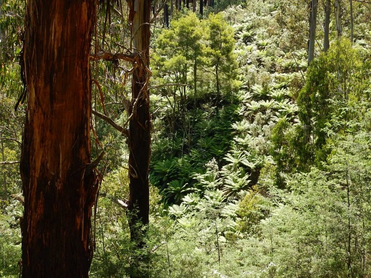

- Goulburn River, very scenic and I just wanted to jump straight in.
Day 4
Campsite near Jamieson – Mansfield on tourist road busy with Boxing Day traffic. Brunch in Mansfield then up Mt Buller.
Pre-riding activities: Up at 5:30am. Pack up bed while I’m still in the tent, get breakfast, map new route for tomorrow to avoid unsealed roads. Looking on target for 8am depart but somehow lost time in getting dressed, packing up tent stuff and getting a bit distracted by my camping neighbour who wanted to chat. He was car camping with his wife but they also do motorbike touring so he was interested in my gear.
Start riding time: 8:40am, then 8:50am after riding 1.5km then remembering to pump up my tyres now I’m back on bitumen!
Finish riding time: 5pm
Total time start to finish: 8:10
Total riding time: 6:30. 2:09 up Mt Buller climb with full luggage, average 7kph.
Total stops time: 1:40
Distance: 80km
Elevation gain: 1670m
Elevation loss: 425m
Average moving speed: 12.7kph
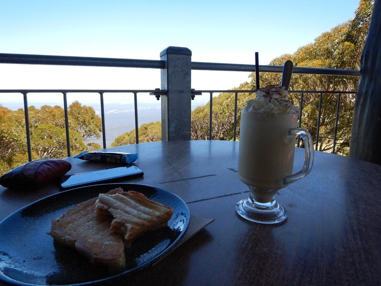
Food: porridge with honey, butter and 3 spoons of MCT oil. Large iced mocha with ice cream, gluten free French toast with berries, maple syrup and bacon. 2 gluten free crumpets with butter, vegemite and cheese slices, 1 Blue Dinosaur Paleo bar. Miso soup, Louisiana mince with quinoa, gluten free chocolate and walnut brownie with Greek yogurt.
Drinks: coffee bag and 3 spoons of Milo in 600mL of water, 600mL water with SIS electrolyte tab, 2L water, 600mL strawberry milk.
Weather: Hot. High 30s and no shade on exposed roads until I started up Mt Buller. Even then the share was intermittent for the first 5km and I was riding any part of my lane that had shade in it. In the shade the temperature felt about 5 degrees cooler, so maybe only low-30s. Finally about 8km before the end of the ride I reached 1000m altitude, and the air temperature slowly dropped about another 5 degrees and the road got more shady – and I didn’t have to pause every 2km in the shade for a breather to prevent myself from getting heat stroke. I realise that riding on exposed roads and up a mountain in the heat of the day is not ideal, but I haven’t been able to manage my logistics otherwise. I have to get from A to B and it takes me 3 hours to get my camp packed up and ready to go in the morning. I’ve been getting up at first light and by the time I leave it is already getting quite warm.
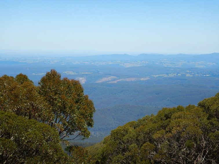
Terrain overview: First 40km to Mansfield were on a road busy with tourist traffic, not much fun. The road was lovely otherwise though, rolling farmland and flat to undulating terrain. Next 35km to the base of Mt Buller was flatter and very exposed but still undulating. Mt Buller itself was a really lovely climb – steady not too steep gradient, around 5%, until the last 2km which was quite steep.
Interesting sights: A filtered water refill station in the middle of nowhere, at this tiny place called Sawmill Settlement, about halfway between Mansfield and Mt Buller. It was at the water treatment plant, and was very handy given the heat today!
Highlights: When I was having brunch at a cafe in Mansfield and the couple who I’d had lunch with yesterday found me! They popped into town for coffee on their way home and saw my bike, so they came in to say hello.
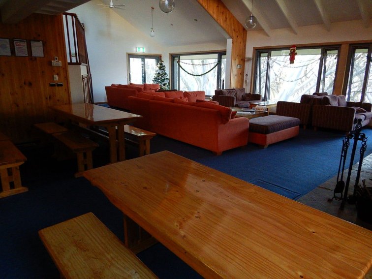
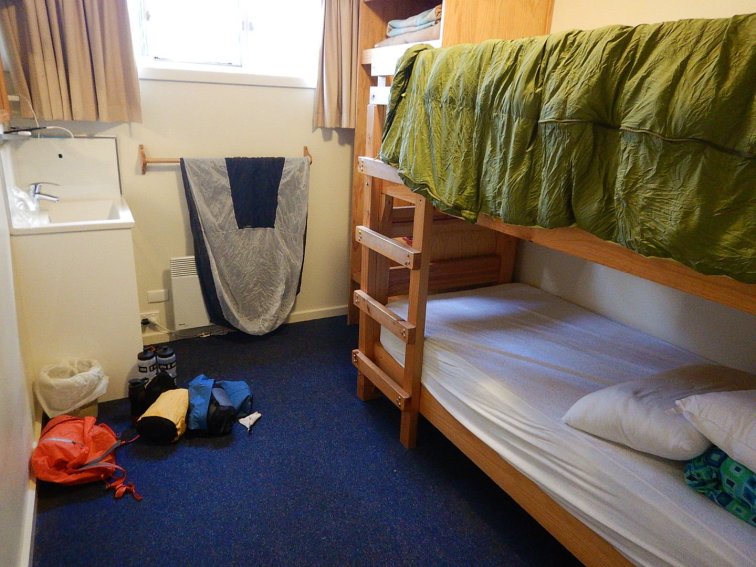
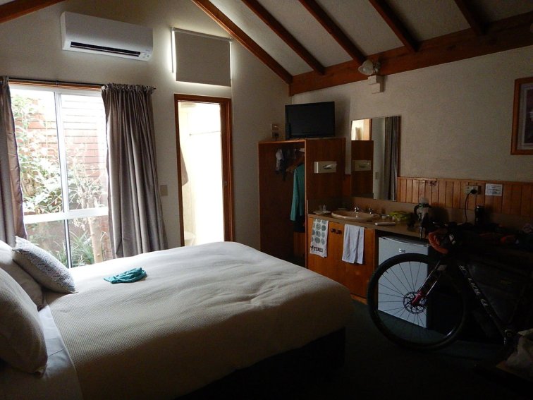
Getting through the day without getting heat stoke. Climbing the glorious Mt Buller with my full luggage with no problems in terms of gearing, and ticking off another of the 7 Peaks! Finding accommodation at the top of the mountain in this awesome ski lodge in a private bunk room, with a terrific industrial communal kitchen, for $54!
What I’ve learnt: Roads that lead to a bunch of river side camp areas are busy with holiday traffic on Boxing Day, people towing boats and caravans and horse floats with little patience. When said roads have no shoulder and cars try to pass you with oncoming traffic, it is safest to ride in the middle of the lane, no matter how much it might annoy the cars behind you, at least you’re looking after your own safety by asserting your position on the road.
Listen to your body in terms of how much, what and when to eat. Eating too much feels as bad as eating too little, particularly as it was hot today. I ate shortly after brunch because I wanted to allow time to digest before getting to the mountain, and I really wanted to get rid of the crumpets I’d been carrying since Perth. I got a bit nauseous afterwards because I was trying to digest in the heat – on the plus side it did get me up the mountain! I’m getting some quite interesting sunburn patterns on my back from getting burnt through my top, but only through bits of it (I discovered the patterns are because my bib knicks and straps for my Personal Locator Beacon harness are protecting some bits from sunburn).
Day 5
Mt Buller – Mansfield – Whitfield – Moyhu – Oxley – Snow Road – Great Alpine Road – Myrtleford. It was a long day!
Pre-riding activities: No alarm set as I’ve been reliably waking up with the birds at 5:30am. Turns out the birds are a lot quieter in the mountains in a ski lodge compared to camping by the river! So I woke up at 6:15am. After my massive three course dinner last night I decided I didn’t need breakfast before I started. I only had 45km to ride to Mansfield where I’d be stopping for a meal, and 15km of that was downhill. Plus I knew time would be off the essence today with a long way to go and a forecast top of 42 degrees. So I packed up as efficiently as I could and headed off.
Start riding time: 7:40am
Finish riding time: 7:35pm
Total time start to finish: 12 hours
Total riding time: 9 hours
Total stops time: 3 hours – breakfast in Mansfield, lunch/ supplies/ cool down stop in Whitfield, cool down and milkshake stop in Moyhu, cool down and hydrate stop in Oxley on a bench in the shade.
Distance: 190km (Garmin fail again, recorded only 185km)
Elevation gain: 1020m
Elevation loss: 2350m
Average moving speed: 20.5 (note for consistency with other days, this is the average speed recorded by the Garmin i.e. including short stops for a minute or two in the shade. Actual average moving speed was 22.5kph)
Food: 3 muesli bars, 2 slices of gluten free toast, 1 avocado, bacon, 2 poached eggs, a large strong iced coffee with ice cream. A sausage roll and sauce. A vanilla milkshake. Miso soup, a bag of instant rice, a small tin of tuna and a tin of corn.
Drinks: 300mL strawberry milk. 1L Gatorade. 500mL hydralyte. 4.5L water.
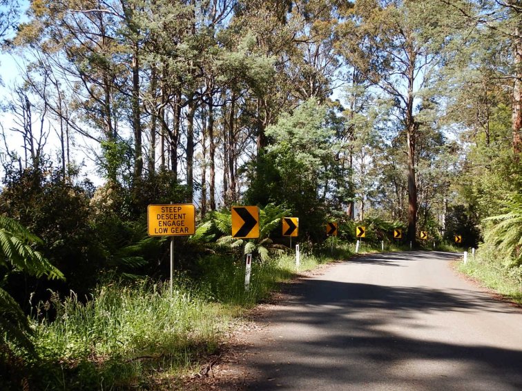
Weather: It started nice! By the time I got to Mansfield it was warming up. Heading to Whitfield it was hot but I was coping ok. I was thinking maybe with all this heat I’ve been exposed to I’m starting to adapt to it. Then I started the descent into Whitfield and it was literally like riding into an oven. I realised that I’d climbed to over 700m altitude, which had taken the edge off the heat. The 25km or so section from Whitfield to Moyhu was crazy hot. Then the 20km from Moyhu to Oxley there was also a strong hot crosswind. As a bonus, I turned east at Oxley and the wind became a tailwind. Also some cloud cover came over blocked out most of the direct sun. And by this time it was 5pm (4pm in real time i.e. without daylight savings) so it gradually started to cool down from the max recorded temp of 42 degrees to a mild 36 degrees when I finished at 7:30pm.
Terrain overview: 15km descent from Mt Buller, then 30km undulating to Mansfield. Mansfield to Tolmy was pretty flat, then it was undulating up and down hill but steadily climbing until 7km out from Whitfield, where there was a big descent and all the elevation gained was lost. After that, pretty flat farming country and pretty exposed.
Interesting sights: The motorcyclist who stopped me to ask what shire was responsible for upkeep of the road, because he’d lost grip on a corner a little way back that had been patched with the melty asphalt and it was, well, melting. He proceeded to tell me how angry he was and how he’d phone them to complain as soon as he got reception, then he rode off and I laughed!
Highlights: Surviving. Coping. Managing myself, my water supplies and my food intake in spite of being on the edge of comprehension most of the day. Not taking a wrong turn. Not getting heat stoke.
Leaving a trail of incredulous people from Mt Buller to Moyhu, amazed and flabbergasted at what I was doing.
The lovely people at the Mansfield Produce Store who took the time to discuss my takeaway food order and how it would last in the heat all day, and were very caring with delivering my strong coffee: the kid who brought it said to let them know if it wasn’t strong enough and they’d make it again! (PS my takeaway ham and cheese croissant was excellent when I ate it the next day).
Arriving at Myrtleford! And the supermarket was still open so I could buy dinner and breakfast supplies! Oh and the descent off Mt Buller was pretty nice.
What I’ve learnt: Slow and steady is faster than stationary. 40 degrees hot water is better than no water.
There are a lot of things we can’t control – e.g. weather, terrain. What we can control is how we react – I’ve not been angry at all, just worried. There is always something to worry about – do I have enough water, will there be anywhere open in the next town, will my luggage be ok with only two fork mount bolts? The list is endless.
The other thing we can control is our choices, and it is a good idea to consciously review those choices to see if there is an alternative or better choice. E.g. today I could have stopped somewhere coolish until it got less hot, then ridden on. But I knew the max temp was forecast between 4-6pm, so that would mean stopping for hours at some random town, then riding the rest of the way in the dark and not arriving until very late. For me, that was a worse choice than riding slowly and drinking hot water but arriving in daylight.
- The beautiful descent back down Mt Buller, before it got hot.
Day 6
Myrtleford – Porepunkah – Mt Buffalo – Bright – Myrtleford
Pre-riding activities: Up at 4:30am (only 5 hours of crappy quality sleep) to beat the heat today. Breakfast from my food supplies, do a few stretches, get dressed and go. Had a chat to my neighbours at my motel who were also up and riding out early on their cruising bikes to Bright after they also struggled in the heat yesterday. We are all crazy!
Start riding time: 5:40am
Finish riding time: 2:40pm
Total time start to finish: 9 hours
Total riding time: 6:40 (2:07 for Mt Buffalo 20km climb without luggage)
Total stops time: 2:20 (looking around top of Mt Buffalo, brunch and looking around Bright, pumpkin seed oil company tasting and shopping)
Distance: 117km
Elevation gain: 1350m
Elevation loss: 1400m
Average moving speed: 17.5kph (9.7kph up Mt Buffalo, rail trail 18kph up the false flat to Bright, then more like 23kph back down the other way)
Food: Pre ride: 2 pieces of gluten free toast with butter, jam and peanut butter, a plum and a small yoghurt. 1.5 muesli bars. Bright Brunch: muesli with fruit and yoghurt, large coffee, freshly squeezed juice. Post ride: sparkling apple juice, ham and cheese croissant, 400mL milk, a peach. Dinner out! Tapas and wine, a delicious treat.
Drinks: 1L water while riding plus see drinks listed above. Plus 1L water with dinner.
Weather: Mild! At least while I was riding. A slight easterly wind, some big fat cold raindrops on the descent from Mt Buffalo (good thing I had my new Rapha rain jacket) then it was quite warm for the ride to Bright and even warmer for the ride back to Myrtleford, but still only low to mid 30s – it didn’t even hit 40 degrees today!
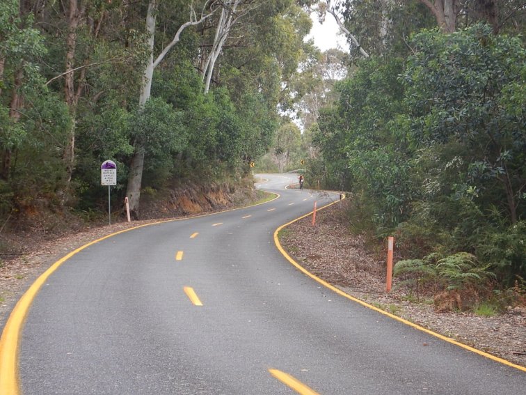
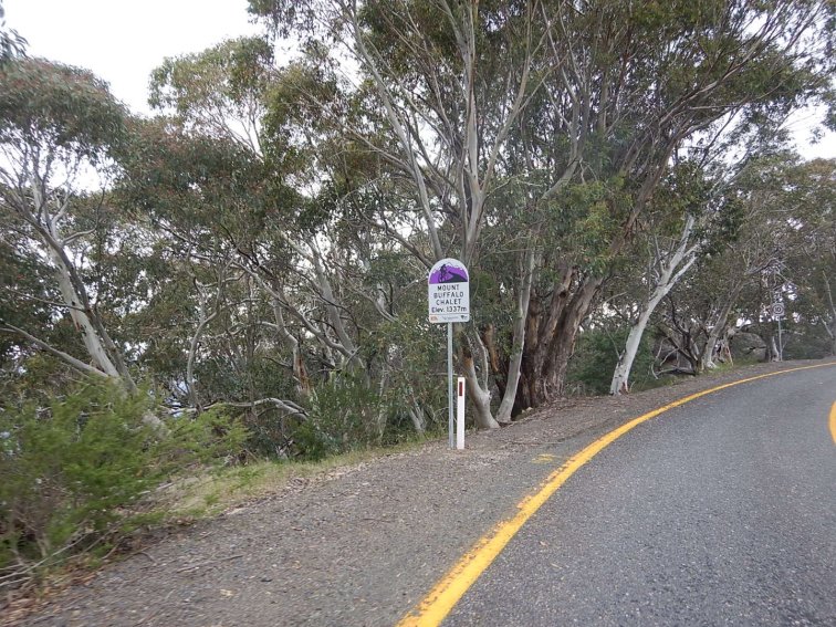
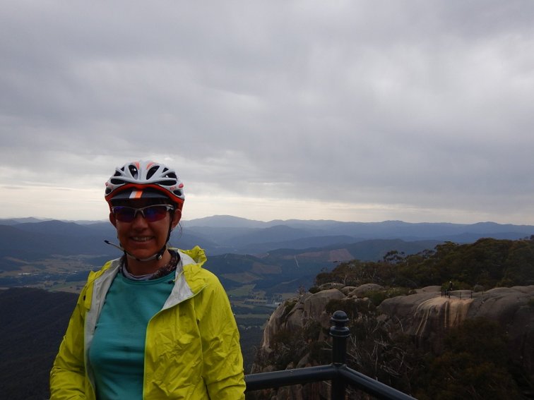
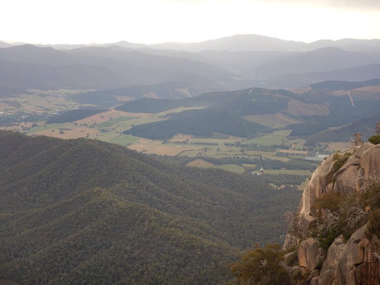
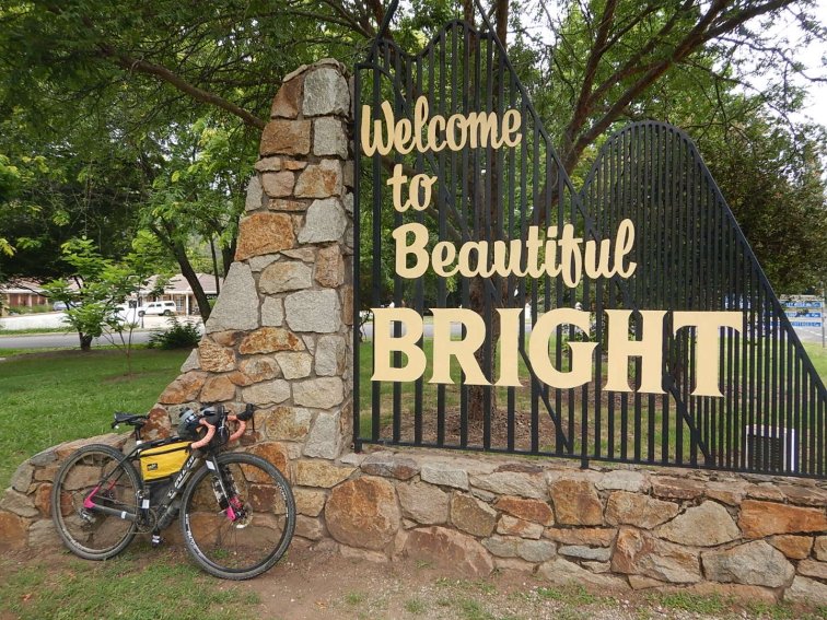
Terrain overview: A slight headwind and ever so slight uphill/ false flat to Porepunkah (23km or so) then turn towards Mt Buffalo. About 10km undulating to get to the official climb start at the historic pay station. The climb itself was 20km and nothing much above 6% or so. Very mild. But there was still my fatigue to deal with, from accumulated cycling plus riding in the heat plus lack of sleep (which was the real issue). And the altitude was affecting me more today than at Buller, which is interesting as Buller was 1600m at the top whereas Buffalo was only 1380m. I probably also didn’t have enough food for the amount of time it took me to get to second breakfast at Bright (5.5 hours). Let’s just say that in spite of the moderate gradient and me pacing myself quite slowly, it was a real struggle and I was barely seeing straight in sections. There were LOADS of other cyclists heading up. I did start to feel better when I saw one lady walking (flat battery on her electronic gears) and shortly after a kid bent over his bike clearly struggling even more than me with the altitude (I later saw him at the top and congratulated him). So after stopping every 5km, I made it to the top (2 and a bit hours for the official climb) and found there was no food or drink anywhere. At least there was a toilet. And a heritage listed historic ski chalet. Back down the mountain, 8km into Bright along the fully sealed Murray to Mountains Rail Trail – it was very popular, which is great as it is a terrific alternative to riding on the shoulder of a busy road. But at this time of year the rail trail users were everything from families with kids on balance bikes who couldn’t ride in a straight line, to older kids pulling wheelies and cycling tourists of every kind. Hectic. Brunch in Bright then 30km along the rail trail back to Myrtleford, with one shopping stop on the way.
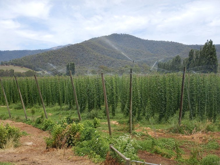
Interesting sights: The distinctive shape of the Myrtleford tobacco drying kiln. A hop farm.
Highlights: Ticking off my fourth of the 7 Peaks, and last one for this trip. Not much more climbing to be done! Tasting, shopping and posting home my shopping from the Pumpkin Seed Oil company.
What I’ve learnt: No matter how crap you are feeling, there is always someone somewhere who is in a worse state. Get into a rhythm and just keep going, but also stop as needed for the mental and physical relief – although be aware that you’ll have to reestablish a rhythm again when restarting. Even feeling rubbish and in need of food and sleep, I still climbed a 20km mountain today – it is amazing what you can do when you just keep pedalling. Lack of sleep is the thing that interferes with my performance and mental fortitude and positive mood the most.
- Heading out (very) early on the Murray to Mountains Rail Trail
Day 7
Myrtleford – Wangaratta on Murray to Mountains Rail Trail. Coach to Melbourne. Cycle Southern Cross Station to my hotel near Southbank.
Pre-riding activities: Up at 6:30am, quick snack to finish my fruit and yoghurt, get dressed and finish packing. Then to the bakery for pre ride coffee, the vanilla slice I’d been wanting for a few days, and a bacon and egg burger for the road – after yesterday I didn’t want to run out of food! Then on the way of town I stopped to check out the phoenix tree sculpture and a historic tobacco drying kiln, which was super interesting.
Start riding time: 8:30am when I finished sight seeing
Finish riding time: 11:45am when I reached a cafe that was open
Total time start to finish: 3:15
Total riding time: 3 hours
Total stops time: 15 min – eating my burger at one of the old railway station rest stops, and patching up my fork mounts with tape after I broke the last two remaining mounts on one side.
Distance: 57km
Elevation gain: 170m
Elevation loss: 233m
Average moving speed: 17.9kph
Food: Pre ride yogurt, plum, peach, vanilla slice. During ride egg and bacon roll. Post ride and remainder of the day: acai muesli bowl, sausage roll and sauce.
Drinks: small coffee, 1L water (during ride), 500mL water, a ginger beer, a milk tea
Weather: warm and humid, a bit sweaty in Wang. Then Melbourne was cool and humid, low 20s.
Terrain overview: Murray to Mountains rail trail Myrtleford to Wang – generally pretty flat, a few gentle climbs, sealed and well signposted. Then I thought I’d booked a train Wang to Melbourne but it turned out it was a coach. Good thing the driver had no issue with me putting my bike in the luggage compartment, not packed in a box. Then about 7km from Southern Cross Station to my hotel, via bike lanes, bike paths and parks and definitely not the most direct route. Melbourne does have great cycling infrastructure though!
Interesting sights: Learning that Myrtleford is the centre of the tobacco growing and processing industry in Australia, with the only process plant and sales floor in Australia. All tobacco produced in the region is used domestically for cigarette manufacturing in Sydney and Melbourne. A paddock full of rusted old cars. A paddock of horses and playful foals.
Highlights: I felt great! My bum was not bothered about sitting on a bike seat (as it had been yesterday), my legs felt good, I had energy. Stopping for my bacon and egg roll at the railway station was fun, these little picnic stops are part of the adventure.
What I’ve learnt: A roll of cloth tape can do a great patch job on luggage mounts. Sleep and coffee do wonders for recovery, energy and mood.

- A hot and humid day already at 8am
- Historic tobacco drying kiln
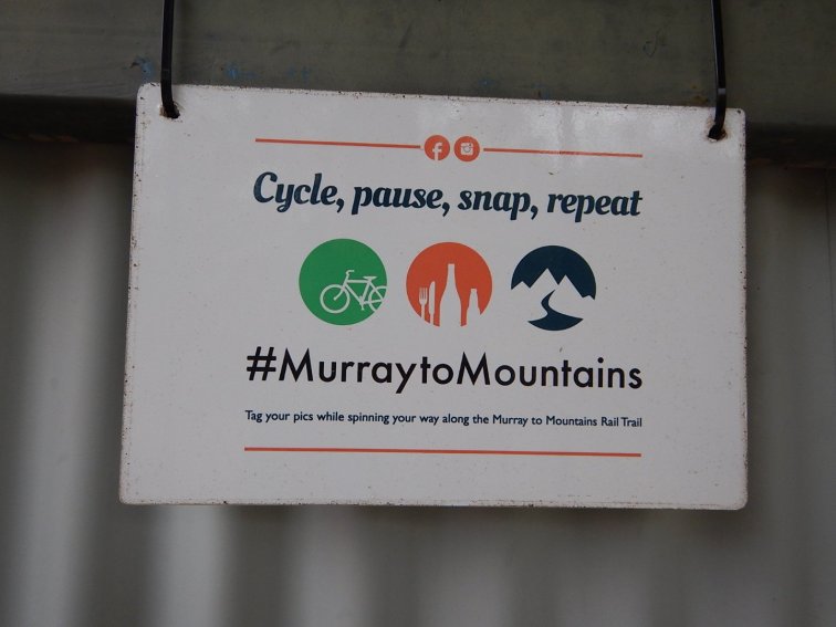
- A stop on the Murray to Mountains Rail Trail – the stops are super well set out, with a rain water tank, toilets and table in the shade
- Farewell mountains

- The things you see in the countryside…
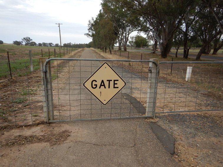
- This is a gate. I guess just in case you are going so fast you don’t see it coming….
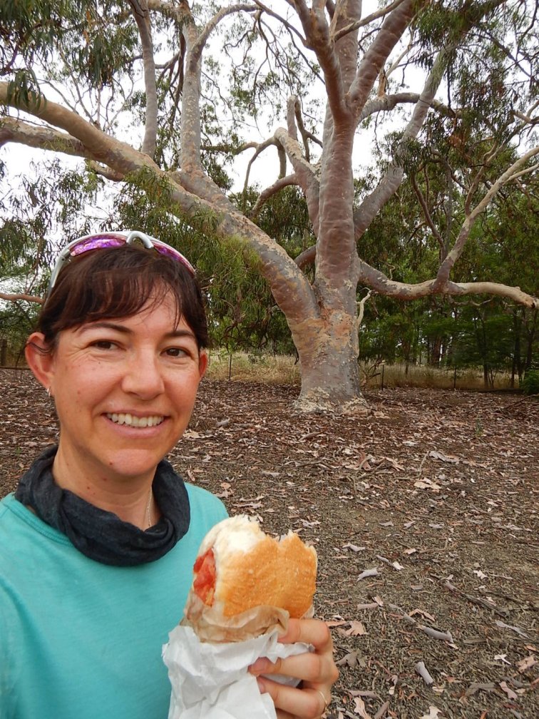
- Picnic morning tea on the rail trail

- Frolicking foals
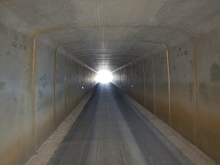
- Tunnel near Wangaratta

- Bridge in Wang
Summary Thoughts
Things I packed but didn’t use:
-
Gear in case of wet weather – spare knicks, spare cycling socks, wet weather gloves, shoe covers, disposable rubber gloves, clothesline
-
Emergency gear – pretty much all my first aid kit, although I did use the deep heat and a couple of antihistamines. Bike spares.
Essential packing list, invaluable items:
-
Sunscreen, sun protective lip balm, insect repellant balm, chamois cream, Assos skin repair gel
-
Merino long sleeve top for cycling, cycling cap, both sets of sunglasses
-
Carabiners, spare voile strap, cargo net and draw cord on my handlebar bag for attaching bits and pieces
-
Handlebar bidon bags that also fit in essential supplies for during the ride
-
Buff with so many uses
Things I’d change:
-
No unsealed roads
-
No crumbly crumpets!
Overall highlights:
-
Camping out and using my tent and bivy. I was just starting to get into the swing of it and would’ve loved three or four nights camping.
-
Meeting people along the trail – at camp sites, on 4WD tracks, at cafes and motels, along the road, at mountain summits.
-
Executing and adjusting the plan. And planning for future adventures.
Overall stats:
7 days
795km
10,600m elevation gain
47 hours riding time 3 more of the 7 Peaks climbed