
Our objectives for this adventure ride were to test our ability to be self sufficient for 2 days (no food or water resupply or electricity) with no cooking gear, plus to be mostly on gravel to avoid towns and traffic on a “long weekend”. And to get away!
Day 1
We left home about 6:15 am. Stopped a few times for toilet and food on the way down. Got groceries at Manjimup Woolworths, had quick brunch (avo, egg and hash browns) with coffee and apple juice and bought a takeaway jaffle at the nearby Two Black Birds Cafe. Found a park with a toilet, parked the car, prepped the food (wraps with salami and cheese plus all the other food into bags) and got the bikes ready. Took about two hours after reaching Manjimup to get ready to go.
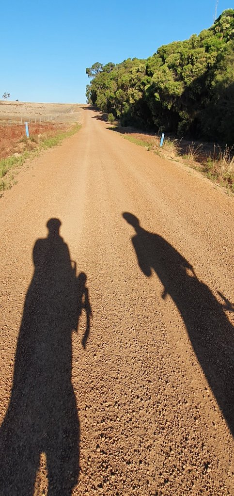
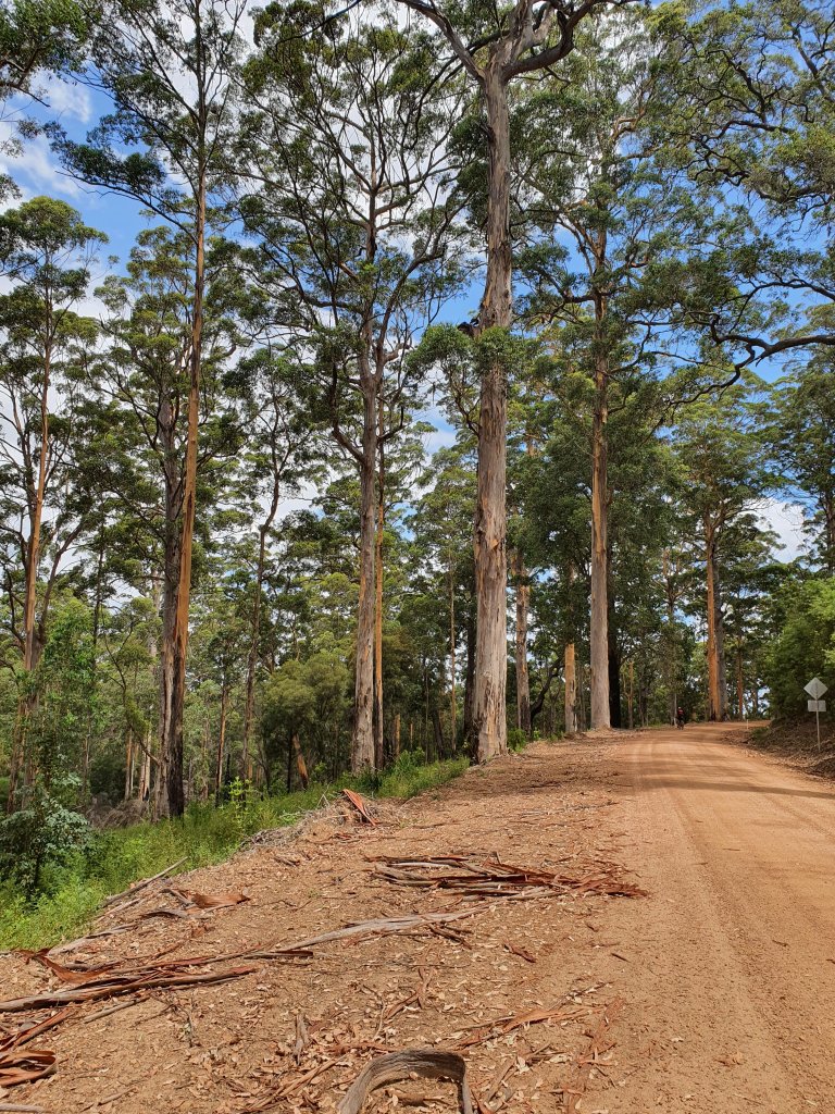
Started riding about 12:30 pm. A few km of bitumen then onto corrugated gravel, although it became better as we got further from town. Our route took us (on a named road) through a gate into a “private property” tree farm. Although the other end of the road had no gate! After leaving the tree farm the gravel became semi soft sand, rideable but sucked the wheels. Then there were big sections of rocky and bumpy gravel. It was also way hotter than forecast, the mild 28 degrees had become 35+degrees in the sun on the bikes. It was a relief to reach Muir Hwy.

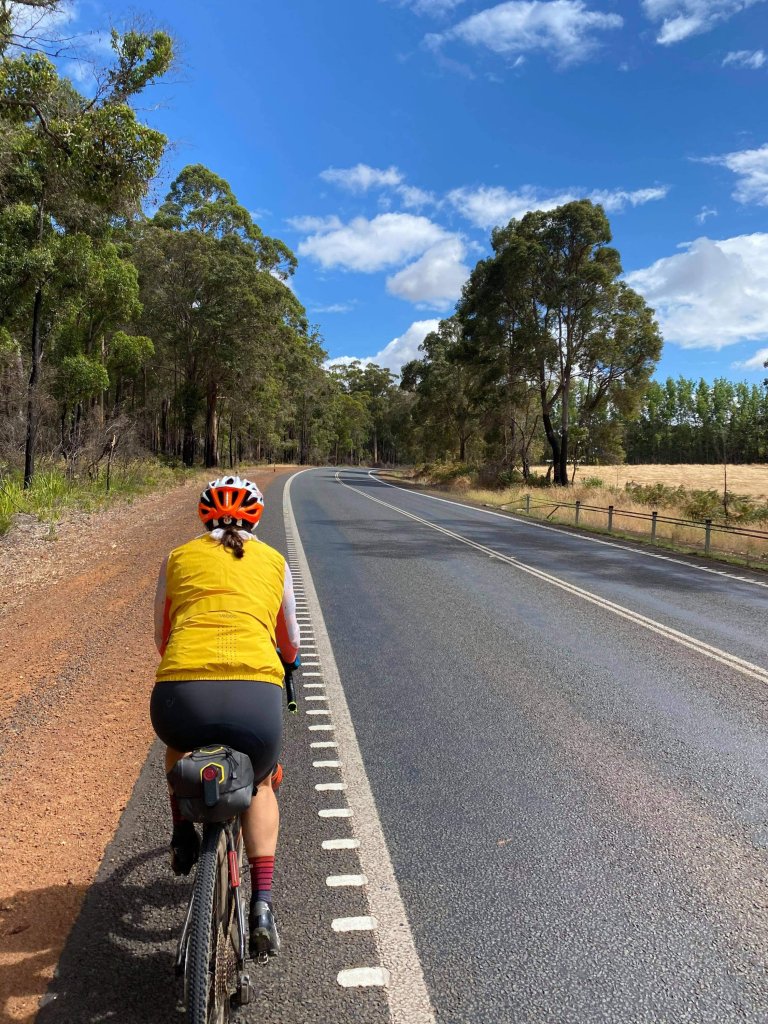
A few kms on the highway, traffic wasn’t too bad. It was quite undulating though and hot still in the sun. So it was nice to again turn off the highway onto gravel and shade. The relief didn’t last long. The gravel road was also undulating. And hot. And the added bonus of rocky and bumpy. It was a struggle.
We got to the end of the gravel onto Perup Rd (bitumen). I was very happy to see a giant hill climb up the road to my left, the direction we had come from, which we had not had to do. So maybe the undulations weren’t too bad. On the bitumen I started riding in my aerobars. I could hear some strange ticking noise coming from near my front wheel. We were both tired so we stopped for a snack of a donut and checked out my wheel. Turns out there was a nail jammed in the tyre. The sealant had done a reasonable job of sealing it so we left it and continued.
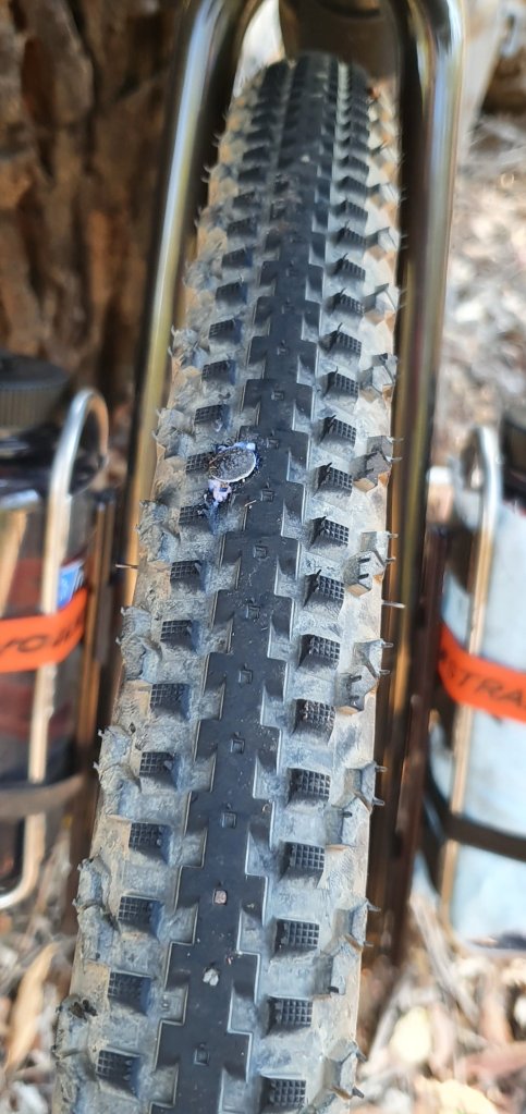
However, we stopped a little while later near a river to possibly get some more water. And I realised air was starting to leak out my tyre. So we pulled out the tubeless tyre plugs…. four plugs later plus three CO2 canisters we had a successful seal. Water from the river was not successful so we continued on.
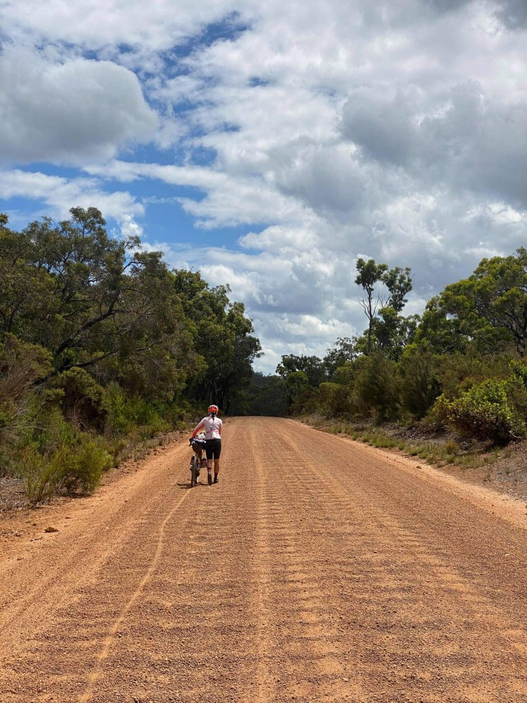
It was a nice long steady section on Perup Rd and it started to cool down towards 25 degrees. We agreed that we would take the 20 km shortcut – along Buranganup Rd. At the turnoff we found Mordalup Bush Fire Brigade – there was a water tank where Greg managed to fill up a couple of litres, which was a relief as he had gone through half his water (almost 3L) in half a day, and we still have all of tomorrow before we reach another town. The short cut road was DELIGHTFUL gravel. I was worried it would be sandy, but only the last bit was sandy and actually we continued on the main gravel road to avoid the sand and it was fine. Such a relief!
We got to Muir Hwy, did about 500 m and reached the Lake Muir observatory. We came in to check it out and decided this is where we are staying tonight. There is a toilet with toilet paper, a tap fed from a small rainwater tank and it is quiet. The lake is dry so there seems low risk of mosquitoes, frogs and other noisy things*. And the observatory platform has a nice under cover area that seems good as a camp site*. We stopped about 6pm, having done 78 km at 18.7 kph moving average. I ate a bunch of apricot slice things and a muesli bar, and drank about 1L on the bike (total). Dinner was an apple, a ham and cheese toastie and about 500mL of water. I was a bit dehydrated and drank about another 500mL overnight and with coffee in the morning.


*Update on the camp site – as the sun set the mozzies came out. Turns out a dry lake is enough to be a mozzie breeding ground. The only solution was to get into our bivvies as quick as possible and chase the mozzies out before doing up the bug net. *On the plus side, upon waking to the sound of rain in the middle of the night, I was pleased our camp and bikes were all under shelter.
Day 2
Up at 5:45 am, eye mask helping me to sleep through sunrise. Cold brew coffee bag coffee (which was delicious – a coffee bag in water overnight. Quick, easy and non messy.) Followed by muesli, banana and milk overlooking the lake. Pack up and get into kit and ready to go by 7:30 am.

The dirt road out to Mt Frankland national park started out ok. The first 20 km I would rate the corrugations as 2 or 3 out of 10. But as we got further down the road they got worse. There were a few points where I actually walked for a bit of a break, so that must be 10/10 bad corrugations. After 45 km we reached the turnoff to Mt Frankland lookout. It was a 7 km ride each way up to the lookout and back, with a pretty decent climb on the way. We discussed options and decided that as we had come this far we should go up to the lookout – we probably wouldn’t be back this way again anytime soon!

So we rode up. The road was about the same for corrugations but made worse by the traffic. It turns out Mt Frankland lookout is pretty popular. Every so often a few cars would come pass, showering us in dust, so they couldn’t see us and we couldn’t see where we were going. I turned on my flashing rear light and tried to keep out of the way – which made the going slower as I was riding in the sandy gutter.
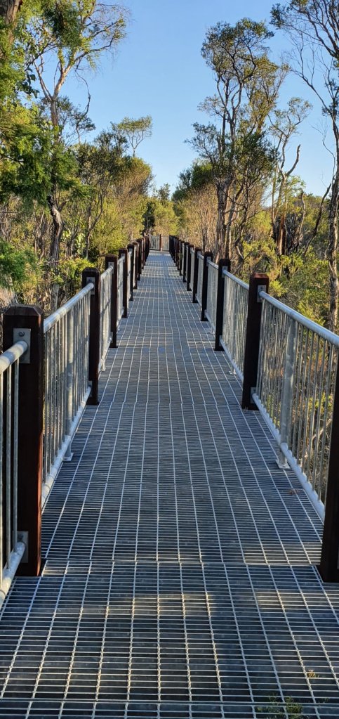
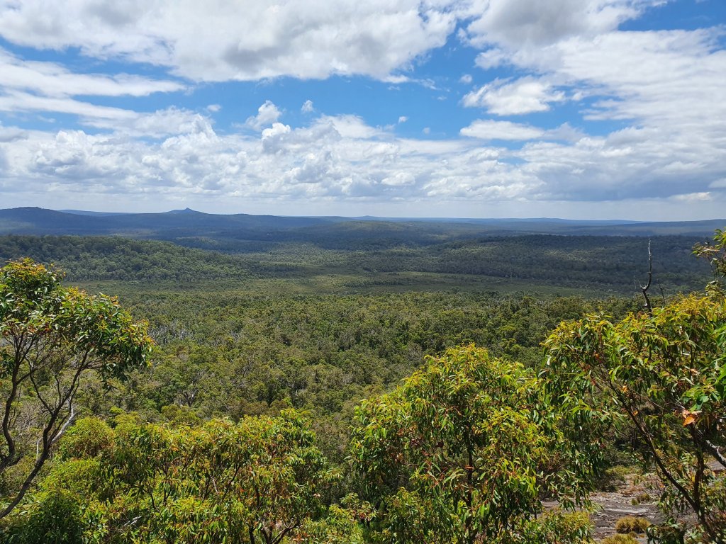
When we got to the top our reward was half of lunch – a wrap with cheese and salami. Yum. Then we did the easy wheelchair friendly walk to the lookout. Amazing views of untouched wilderness as far as the eye can see.
Back to the bikes and back 7 km of corrugated road. With a pause in the middle – Greg realised he had left our Personal Locator Beacon at the top. He flagged down a car and they were nice enough to go find it and bring it back down to us. So much faster than trying to cycle the 1.5 km climb back to the top! Back at the “main road” intersection, we had already decided we would abandon the planned route which took us on a 40 km loop south then back north. So we headed directly east on a shortcut to get back to South West Highway. It was still gravel but it started out nice and smooth and had glorious views of tall trees and bush.

That lasted for about 5-6 km. The remaining 20 km were horribly corrugated across the entire width of the road. The advantage of riding a bike on corrugations is that you can pick a line that is not so bad. But on this road, all the lines were terrible. The whole width of the road was corrugated except for the sandy steep edge. So it was slow and I walked a whole bunch. The final 6 km took 60 min. It was a slog.
Finally we reached South West Hwy. The original route had us going off into the gravel unknown for another 50 km or so towards Northcliffe. By this time it was 4 pm and I couldn’t face any more corrugations. Greg found the Shannon National Park camp ground on maps, which was some 30 odd km up the highway, but just off the highway. It was decided. So we rode a very undulating 30+km. It was a relief to be on bitumen, on road that didn’t move underneath you or try to buck you off the bike. But I was still very tired and my hands were so sore from being braced on my bike hoods all day. But my legs still worked and I kept up a steady supply of peanut m&ms and water for fuel and we made it before 6 pm. Winning! There are hot showers and flushing toilets and camp sites under the pines. Today was around 110 km (Garmin seemed not to record some of the walking), a bit over 10 hours elapsed time. I drank 2L of water (it was a mild mostly overcast 20 degrees day). Plus a large cold brew coffee at breakfast. Food for breakfast was paleo muesli with a banana and 100mL of milk. During the day I ate the reminder of my apricot slice, about half my peanut m&ms, two salami and cheese wraps and two muesli bars. Dinner was a foil packet of tuna and beans, half an avocado, a slice of cheese and a wrap. It was all delightful and sufficient, although I’d love a square of dark chocolate after dinner. We were chased into the bivvies again tonight, this time by rain. Thankfully it didn’t last too long so I could open up my bivvy window.


Day 3
I woke up 5:15 am and rose at 5:30 when the stomach said it was food time. It started raining immediately when I got up so I quick smart packed away my sleep system. Thanks to the picnic table sheltered by a tree everything stayed dry. I also learnt that shoving my quilt under my down jacket while packing everything else keeps it dry! I was packed and had breakfast and was ready to go before 7 am. I think around 1:15 of pack time, which is 30 min faster than yesterday. We were on our way by 7:30 am in spite of Greg not getting up until 6:30 am.
Today we took South West Highway all the way back to Manjimup. It was 55 km all up. The original plan had been a gravel route but we weren’t interested in that. Traffic was generally pretty quiet until the last 15 km in to Manjimup after the Vasse Hwy intersection. It was a bit drizzly for the first 5 km or so, which gave me the chance to test out my new Velocio rain gilet – it was excellent! High visibility, breathable on the climbs and warm on the descents. And there were lots of climbs and descents – very undulating pretty much the whole way. A lovely ride though, scenic tall trees and legs felt pretty good. I slept well last night after a tough day yesterday so I felt good today.
The last 3 km were on the bitumen rail trail into Manjimup. And 600 m outside of town my plugged front tyre failed, the plugs popped out and I lost all the air. So I walked the last 600 m into town – all my walking training yesterday paid off. I was walking at only 3 kph in gravel corrugations yesterday. Today I was walking at almost 5 kph with a flat tyre on the bitumen bike path. We finished around 10:30 am with an average speed of 19.6 kph (before the walking bit) with knobbly tyres on undulations. Water consumed <500mL, food consumed one muesli bar and approx 100g peanut m&ms. Post ride coffee and food, unpack the bikes, change and drive back to Perth.

Reflections
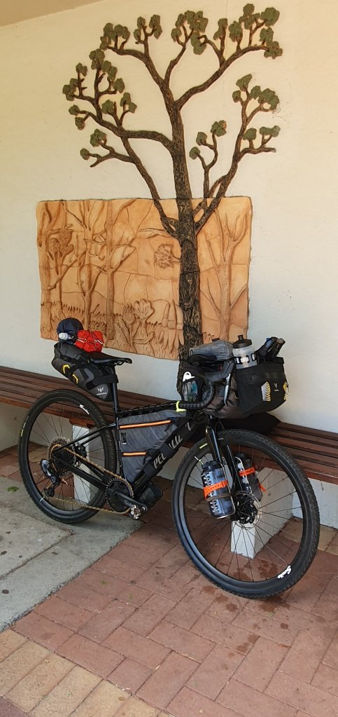
Although we rode only 140 km of the planned 309 km route, the trip achieved every objective. (Our total distance was 244 km but 104 km of that was off piste ie the shortcuts plus the highway on the last day).We did two days (46 hours) between resupply points. I was entirely self sufficient for that time, with no resupply even for water. I went through 4.5L of water in total and ate all my food except for one muesli bar. I actually carried more water than I used. I had 2 x 1L bottles on my forks, 1 + 0.75L in my Apidura race handlebar bag, and 2 x 0.75L with one in a jersey pocket and one strapped to my saddle bag. So that’s 5.25L all up.
Food and meal plans were perfect. The food lasted well, was delicious and nutritious and satisfying.
We also did a great job of riding mostly off main roads and away from possible holiday traffic. And people.
